 Download
City routes, live traffic, transit routes, parking, offline map and navigation.
We've updated 2GIS to better showcase the extensive information we've gathered about cities and companies. The new version features a refreshed design, an enhanced search function, improved city updates, and integrates favorites with 2gis.ru.
Services, addresses, and companies
With 2GIS, you can easily find out which service provider operates in your building, locate your nearest district hospital or post office, and choose cafes or service centers based on reviews and photos. The app provides detailed information including opening hours and contact numbers.
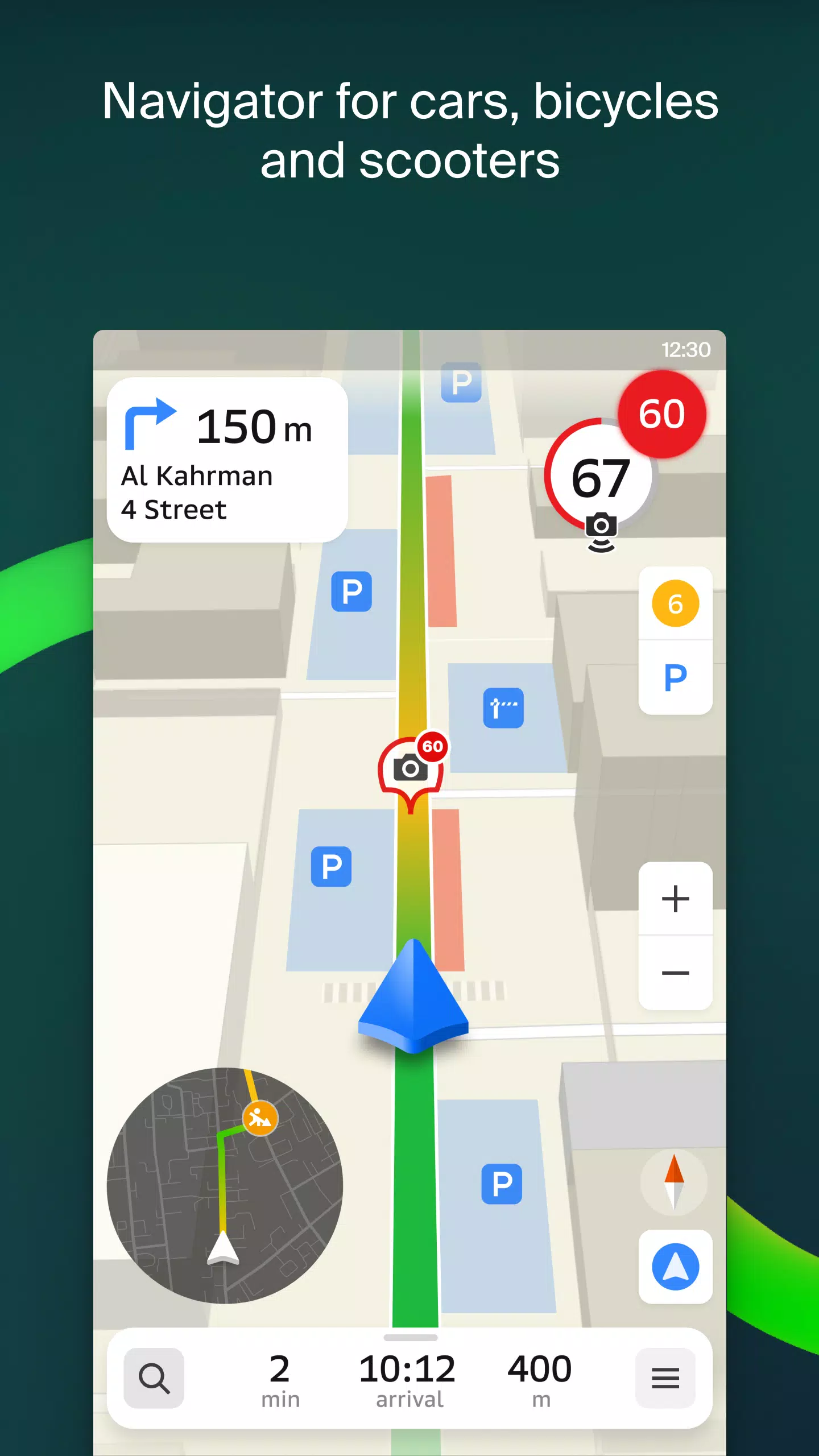
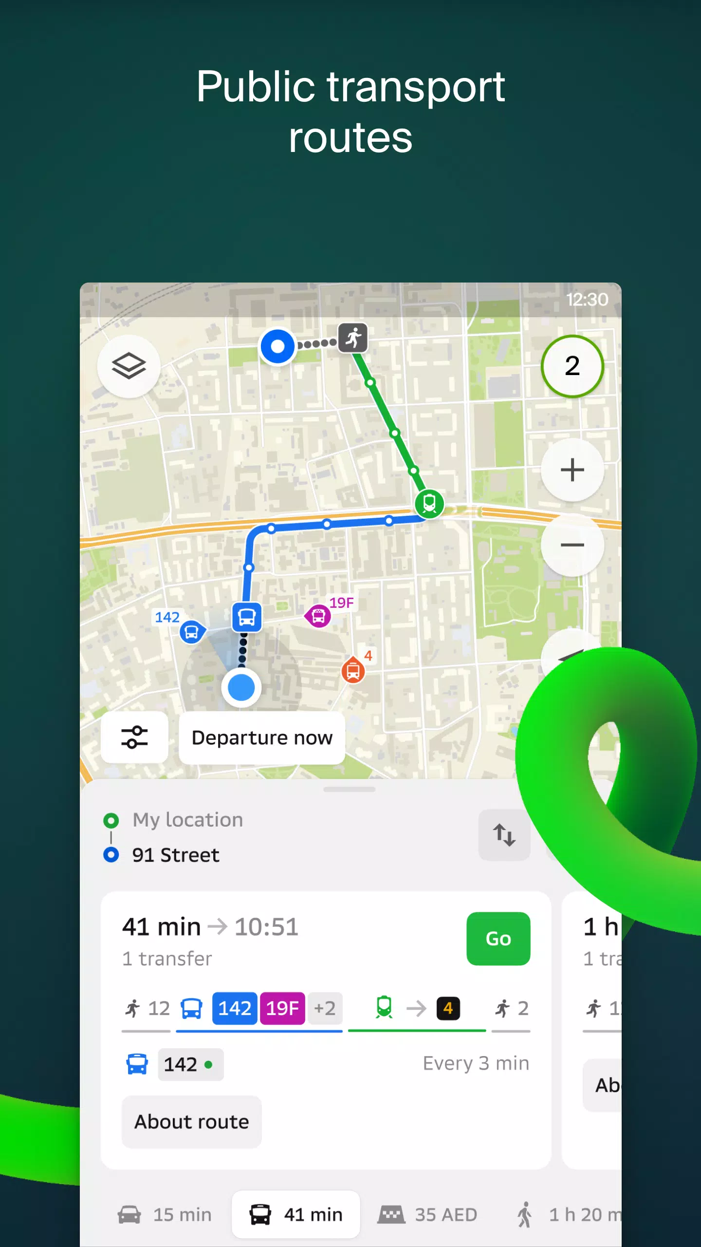
Transport and navigation
For drivers, 2GIS offers real-time guidance with voice instructions, taking into account traffic conditions and roadblocks. It dynamically updates your route if you deviate from the planned path. For pedestrians, the app suggests routes using buses, metro, trains, cable cars, and river trams.
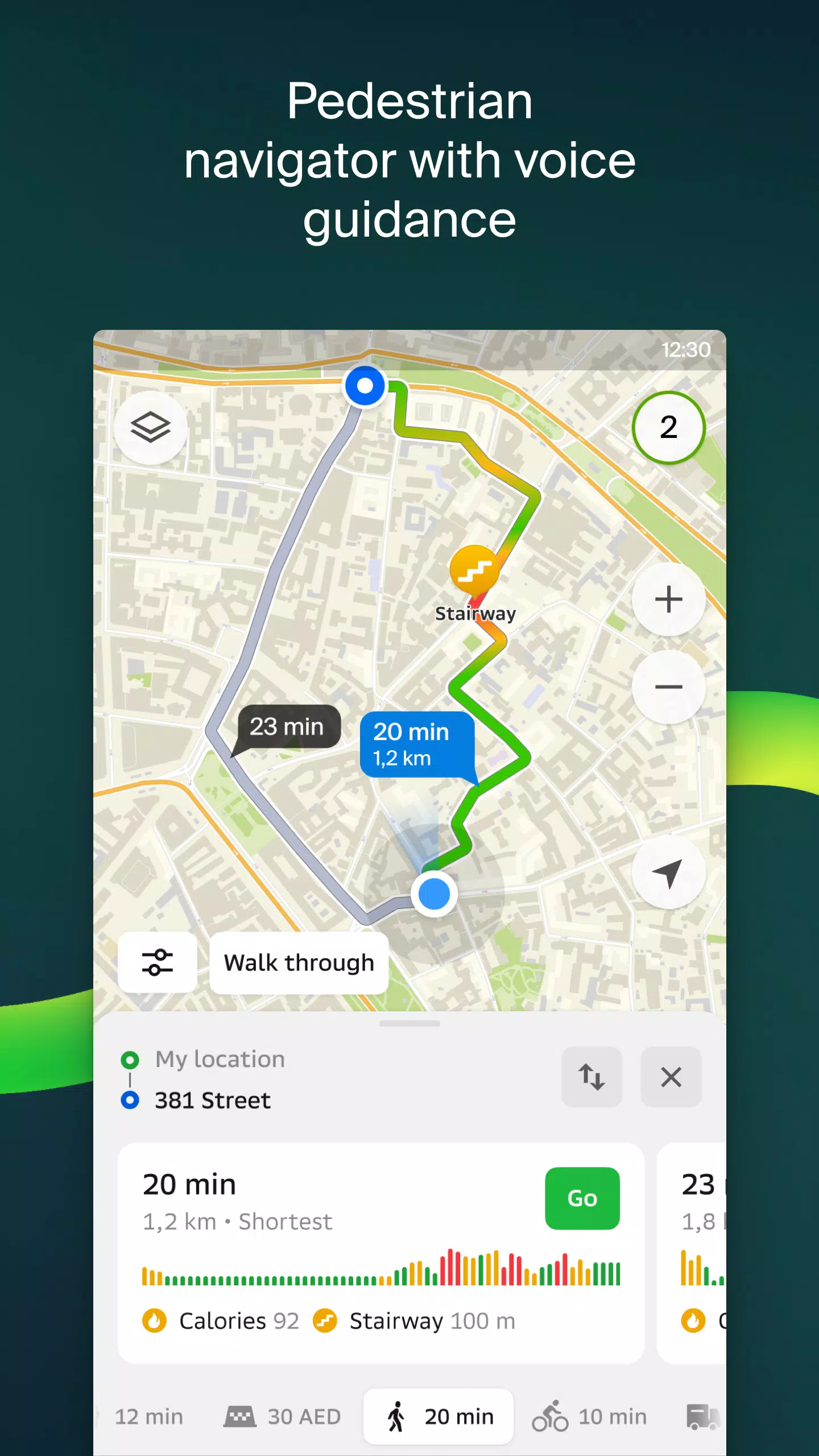
Walking routes
2GIS's pedestrian navigation guides you on foot, works seamlessly in the background, and includes voice guidance to ensure you reach your destination effortlessly.
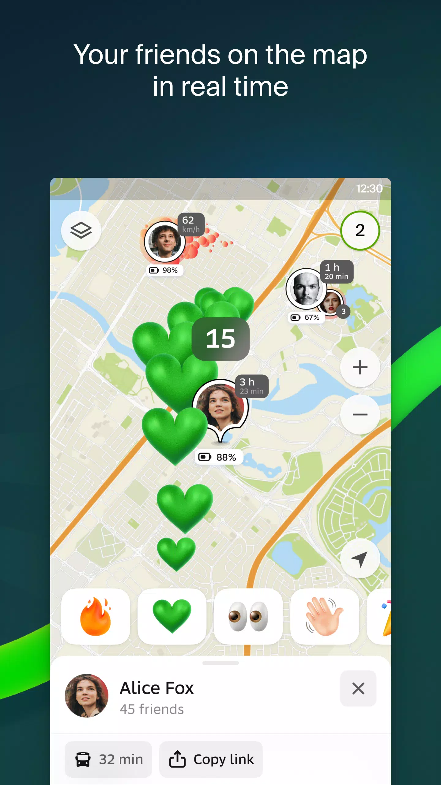
Friends on the map
Keep track of your friends and family in real-time with 2GIS. You can choose who to connect with and manage your visibility settings to control who sees your location.
Building entrances
Avoid the hassle of finding the right entrance to a business center. 2GIS has detailed information on how to enter over 2.5 million companies, and it will guide you directly to the entrance whether you're walking or driving.
Plans of shopping centers
Navigate inside shopping centers with ease using 2GIS. It maps out everything from shops and cafes to ATMs and restrooms, helping you plan your visit efficiently.
2GIS beta Notifications companion app for smart watches on Wear OS
Enhance your navigation experience with the 2GIS beta Notifications companion app for smartwatches running Wear OS 3.0 or later. This app offers route navigation for walking, biking, or public transport directly from your wrist, including map views, maneuver hints, and vibration alerts as you approach turns or bus stops. The companion app auto-starts when you initiate navigation on your phone.
By using the beta version, you'll receive the latest updates and contribute to the development of 2GIS, which will soon be used by millions. You can run both the original and beta versions simultaneously and switch between them as needed.
Support: [email protected]
What's New in the Latest Version 6.44.1.559.3
Last updated on Oct 19, 2024
We've made some exciting updates to enhance your experience:
- Enjoy wide, realistic road depictions on the main map and during route searches.
- Connect with friends through our new in-app Chats feature, allowing seamless communication without leaving the map.
- Get notified when friends are nearby; this feature can be toggled in the settings.
- For ski enthusiasts, we've added ski lift statuses to keep you informed about open slopes.
- For routes involving public transport and walking, we now calculate the walking segment in steps for more accurate navigation.